
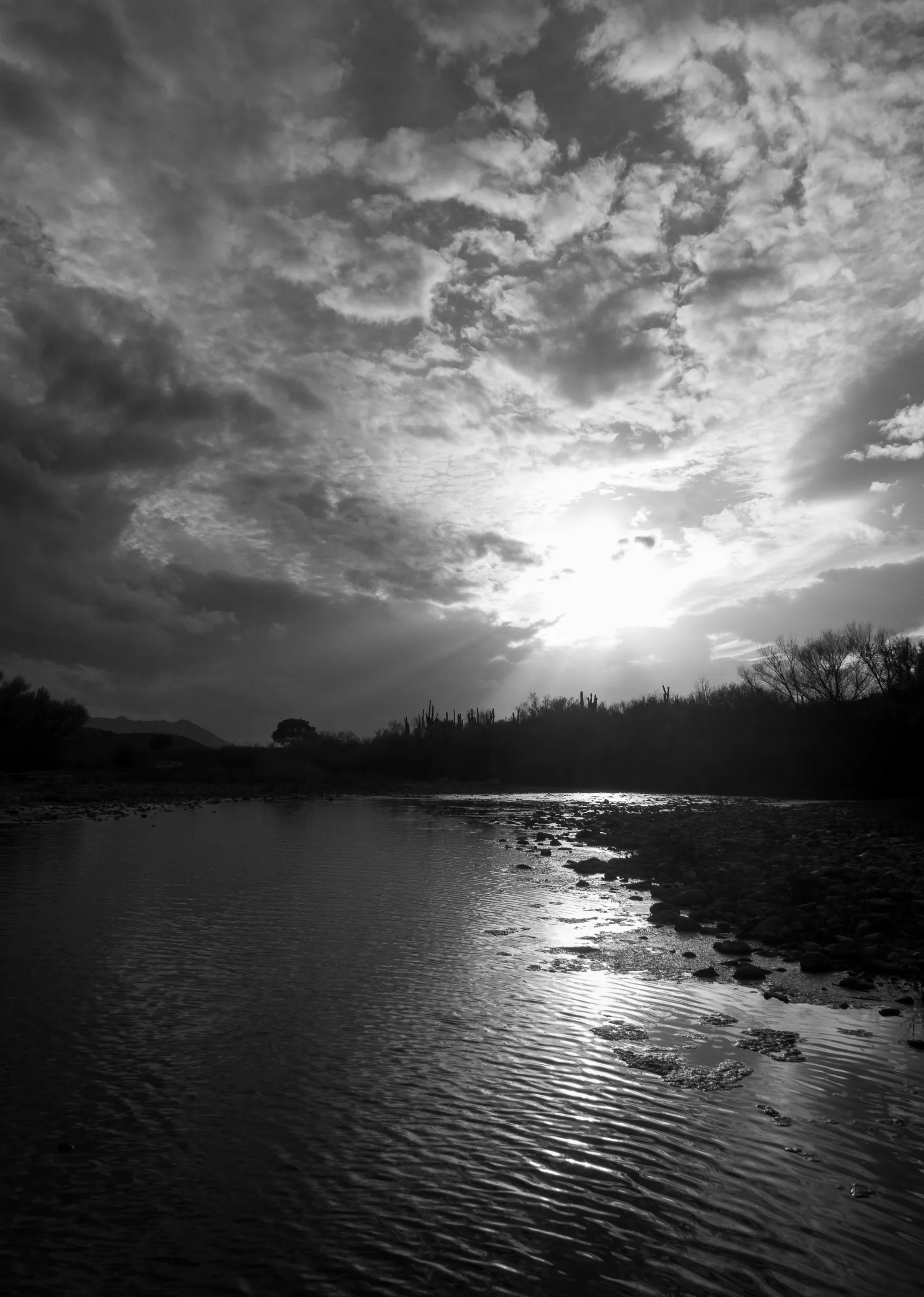
Lower Salt River — Water Users to Granite Reef Paddle
Mesa / Salt River, Arizona
Activity
Kayaking / Paddleboarding
Distance
5 mi round trip
Route
One-way river paddle
The adventure
Float between cottonwood-lined banks and rugged desert cliffs on a river where wild horses sometimes appear beyond the reeds.
The lower Salt River offers a moving-water paddle through a corridor of riparian greenery and Sonoran Desert mountains. Depending on releases, sections can have current, shallow riffles and obstacles. Launch at the established Water Users river access and paddle downstream to the Granite Reef take-out, with a prearranged vehicle shuttle.
THE EXPERIENCE
Launch at the established Water Users river access and paddle downstream to the Granite Reef take-out, with a prearranged vehicle shuttle. The lower Salt River offers a moving-water paddle through a corridor of riparian greenery and Sonoran Desert mountains. Depending on releases, sections can have current, shallow riffles and obstacles. The reward is not just the destination: it is the changing scenery, the effort of moving through it, and the satisfaction of completing a real outdoor route.
WHAT MAKES THIS PLACE SPECIAL
The lower Salt River is a major recreation corridor below Saguaro Lake, supporting paddling, tubing and river-based wildlife experiences. Pause in a calm reach to watch the contrast between riparian cottonwoods and the surrounding desert slopes. This is a destination with a distinct personality rather than a generic viewpoint stop.
ROUTE AND TERRAIN
Plan for approximately 5 miles on a one-way river paddle route, with a working elevation-gain estimate of 0 feet where applicable. The lower Salt River offers a moving-water paddle through a corridor of riparian greenery and Sonoran Desert mountains. Depending on releases, sections can have current, shallow riffles and obstacles. Choose a pace that matches the terrain and your party abilities; actual mileage may vary with route choices.
ONCE YOU’RE THERE
Use the signed Water Users recreation site for launching and the Granite Reef recreation access for take-out. Arrange two vehicles or a shuttle in advance and check recreation-pass requirements. Follow official posted signs and the current route map rather than improvised shortcuts.
FIELD GUIDE — WHAT TO NOTICE
Pause in a calm reach to watch the contrast between riparian cottonwoods and the surrounding desert slopes. The lower Salt River is a major recreation corridor below Saguaro Lake, supporting paddling, tubing and river-based wildlife experiences. Look for the small transitions in terrain, vegetation and light that are easy to miss when focused only on the finish.
SAFETY AND PREPARATION
Confirm river releases and take-out access; never paddle a route without knowing its current and hazards. Wear a PFD and keep distance from wild horses and other wildlife. Carry appropriate water, sun protection, offline navigation and a backup plan; conditions can change quickly.
FEES AND ACCESS
A park admission, recreation pass or required permit may apply. Confirm the current fee and access rules with the managing agency before departure.
BEST TIME TO GO
Spring through fall when river flows and access are suitable. Start early when temperatures or storms are a concern, and check current closures and access conditions.
What to expect
- Float between cottonwood-lined banks and rugged desert cliffs on a river where wild horses sometimes appear beyond the reeds.
- The lower Salt River offers a moving-water paddle through a corridor of riparian greenery and Sonoran Desert mountains. Depending on releases, sections can have current, shallow riffles and obstacles.
- Launch at the established Water Users river access and paddle downstream to the Granite Reef take-out, with a prearranged vehicle shuttle.
- Pause in a calm reach to watch the contrast between riparian cottonwoods and the surrounding desert slopes.
Good to know
- The Route
- Launch at the established Water Users river access and paddle downstream to the Granite Reef take-out, with a prearranged vehicle shuttle.
- Terrain
- The lower Salt River offers a moving-water paddle through a corridor of riparian greenery and Sonoran Desert mountains. Depending on releases, sections can have current, shallow riffles and obstacles.
- Getting Started
- Use the signed Water Users recreation site for launching and the Granite Reef recreation access for take-out. Arrange two vehicles or a shuttle in advance and check recreation-pass requirements.
- Safety
- Confirm river releases and take-out access; never paddle a route without knowing its current and hazards. Wear a PFD and keep distance from wild horses and other wildlife.
- Local Detail
- Pause in a calm reach to watch the contrast between riparian cottonwoods and the surrounding desert slopes.
- Fee
- Required: A required entrance fee or recreation pass applies; verify current rates with the managing agency.
- Dogs
- unknown.
- Season
- Spring through fall when river flows and access are suitable
Photos
More adventures nearby
Butcher Jones Recreation Site · Salt River, Arizona
Saguaro Lake — Desert Cove KayakingKayaking & Paddling · Moderate · ~2 mi away
Wind Cave Trailhead inside Usery Mountain Regional Park · Mesa, Arizona
Usery Mountain Regional Park — Wind Cave TrailHiking · Moderate · ~7 mi away
Siphon Draw · Apache Junction, Arizona
Lost Dutchman State Park — Siphon Draw TrailHiking · Hard · ~8 mi away