
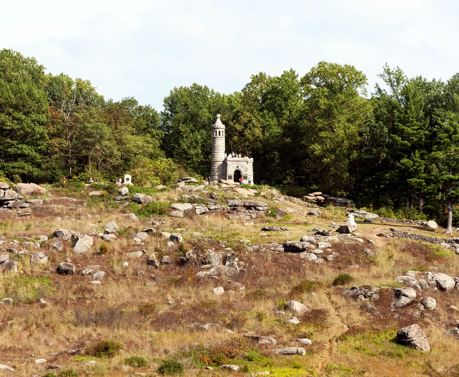
Gettysburg National Military Park — Little Round Top
South-Central Pennsylvania / Gettysburg, Pennsylvania
Activity
Historic Outdoor Experience / Battlefield Walk
Distance
2.3 mi round trip
Elevation gain
~250 ft
Route
Historic hill trail exploration
The adventure
Walk the restored trail system over one of Gettysburg's most recognizable pieces of battlefield terrain. Explore Little Round Top on foot through the formal trail system rebuilt to reveal the hill instead of simply driving to its summit.
This 2.3-mile historic hill trail exploration adventure in South-Central Pennsylvania / Gettysburg is best approached as a real outing, not simply a pin on a map. The experience centers on Gettysburg National Military Park — Little Round Top, with the route and stopping points chosen to make the defining features accessible from the documented public starting point. Allow time to enjoy the setting rather than racing through it.
GETTING THERE & STARTING OUT Use the NPS gravel parking at Wheatfield Road and Sedgwick Avenue. Cross only at the established access and take the formal wooded trail toward Little Round Top. Once on the hill, remain on the new designated trail system and use NPS interpretive stops to explore the summit and slopes. Do not use closed social trails or climb monuments. Loop through the formal routes and return to the Wheatfield/Sedgwick parking. Your documented starting point is Wheatfield Road / Sedgwick Avenue Gravel Parking. Use that access rather than navigating directly to a scenic feature, which may not have legal parking or a public approach. For driving navigation, the recorded destination is Wheatfield Rd & Sedgwick Ave, Gettysburg National Military Park, Gettysburg, PA 17325.
THE ROUTE & WHAT TO EXPECT The recorded outing is approximately 2.3 miles with about 250 feet of elevation gain and is categorized as moderate effort. The recorded time allowance is 1–2 hours. The route information describes the intended experience, not a guarantee that every segment is signed or maintained. Use the land manager’s current map and posted instructions to make decisions at junctions.
WHAT MAKES THIS PLACE SPECIAL Little Round Top reopened in 2024 after a major rehabilitation that replaced damaging social trails with formal routes. NPS now has about 2.3 miles of hiking trails throughout the Little Round Top area. NPS encourages visitors able to walk to use satellite parking and approach the summit on foot. The official NPS self-guided Little Round Top tour contains nine stops and typically takes 20–90 minutes.
LOOK CLOSER Use the formal trail system to reach the 20th Maine monument on the southern slope and connect the terrain below the summit with the story told above it.
SEASON, CONDITIONS & SAFETY Battlefield grounds are generally available year-round during park hours; snow, ice, heat and special closures can affect the trail system. Relevant hazards identified in the source research include road crossings, summer heat, winter ice, uneven battlefield terrain. Before leaving, check temporary battlefield closures, special events, parking availability, snow or ice. Dogs are recorded as allowed on leash; follow all posted rules and keep them controlled.
BEFORE YOU GO No permit, reservation or paid tour is required to complete the self-guided outdoor Little Round Top walking Challenge. NPS lists the battlefield parking used for this outing as free and no outdoor entrance fee is required to walk Little Round Top. Check current hours, trail or tour availability, and on-site signs before traveling. Bring appropriate water, footwear and layers for the terrain and forecast. Respect closures, neighboring private land and any protected natural or historic features.
What to expect
- The recorded outing is approximately 2.3 miles with about 250 feet of elevation gain and is categorized as moderate effort. The recorded time allowance is 1–2 hours
- Little Round Top reopened in 2024 after a major rehabilitation that replaced damaging social trails with formal routes
- NPS now has about 2.3 miles of hiking trails throughout the Little Round Top area
- NPS encourages visitors able to walk to use satellite parking and approach the summit on foot
Good to know
- NEW TRAIL SYSTEM
- Little Round Top reopened in 2024 after a major rehabilitation that replaced damaging social trails with formal routes.
- EXPLORE THE HILL
- NPS now has about 2.3 miles of hiking trails throughout the Little Round Top area.
- LEAVE SUMMIT SPACE
- NPS encourages visitors able to walk to use satellite parking and approach the summit on foot.
- FOLLOW THE STORY
- The official NPS self-guided Little Round Top tour contains nine stops and typically takes 20–90 minutes.
- FIND THE 20TH MAINE
- Use the formal trail system to reach the 20th Maine monument on the southern slope and connect the terrain below the summit with the story told above it.
- Dogs
- allowed-on-leash.
- Season
- Battlefield grounds are generally available year-round during park hours; snow, ice, heat and special closures can affect the trail system.
Photos
More adventures nearby

Catoctin Mountain Park · Catoctin Mountains, Maryland
Link Chimney Rock and Wolf RockHiking · Strenuous / steep, narrow and rocky · ~16 mi away

Cunningham Falls State Park Houck Area trail · Catoctin Mountains, Maryland
Climb to Cunningham FallsHiking · Moderate / rocky mountain waterfall hike · ~17 mi away
Pole Steeple Trail · South Mountain, Pennsylvania
Pole Steeple Trail — Michaux State ForestHiking · Moderate · ~17 mi away